Project Introduction
As giraffe have been listed as ‘Vulnerable’ by the IUCN Red List of Endangered Species and their numbers across Africa continue to decrease, it is essential to understand the species’ needs to provide appropriate conservation strategies and management. Namibia is one of the only few countries in Africa in which giraffe numbers are growing, with approximately a total of 12,000 Angolan giraffes (Giraffa giraffa angolensis) and 100 South African giraffes (Giraffa giraffa giraffa) in National Parks, communal land and private land.
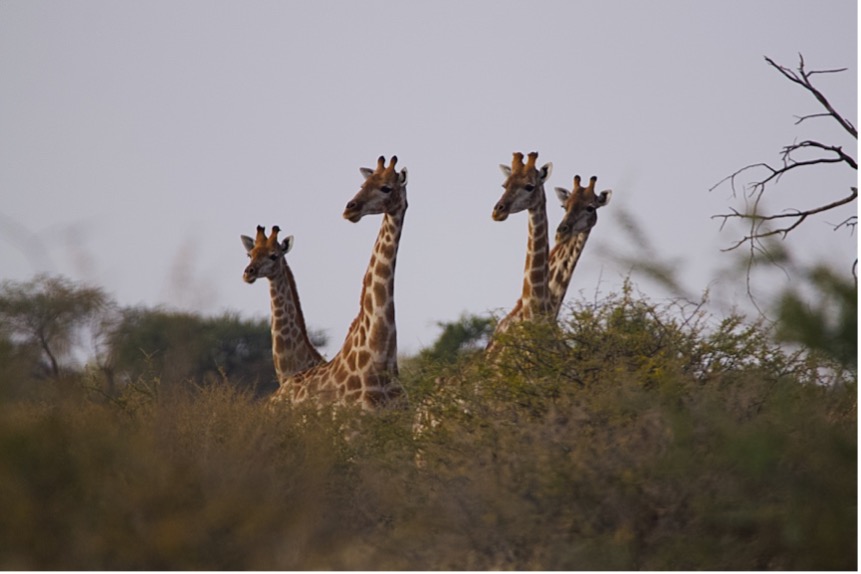
Figure 1: Four giraffe looking over the bushes at Kuzikus Wildlife Reserve
The giraffe population at Kuzikus Wildlife Reserve (originally 5 individuals brought from Etosha National Park) has increased over the past years and the number of individuals is estimated at around 50, but the population remains understudied. Being in a closed system that protects the population from major threats such as habitat loss and fragmentation of subpopulations offers the opportunity to study how the species is using the reserve.
Objectives of the Project
- To identify individuals using a pattern recognition software to gain knowledge on exact population numbers and population structure, e.g. the male to female ratio and the number of young individuals
- To identify the areas in which giraffe are present in Kuzikus Wildlife Reserve and establish key characteristics of these areas
- If possible, to determine home ranges and territories of individuals combining the findings on individual identification and location
Overview of Methods
1. Giraffe location recordings: Every giraffe sighting is recorded via GPS. Drives through the reserve are conducted either in the morning or in the last hours before sunset, driving alternately through the Western and Eastern sides of Kuzikus to cover the different areas equally. Information on numbers of individuals per group, as well as group structure and behaviour is also collected.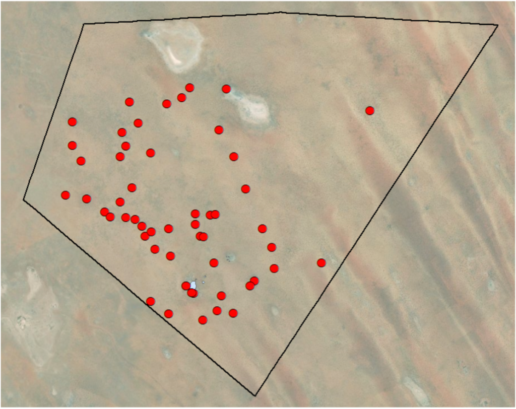
Figure 2: Giraffe sightings (marked by red dots) within Kuzikus Wildlife Reserve from mid-June to mid-July 2021
2. Giraffe identification: During every sighting, if the distance to the individuals allows it, photos of the left side of the giraffes are taken. The photos are then uploaded to the software Hotspotter, which runs an analysis comparing the patterns of the individuals, looking for similarities. The proposed matches are then checked visually.
3. Habitat use analysis: Combining the collected information on giraffe location and WIL’s software, habitat use maps can be created. WIL’s digitalization of the reserve will allow to establish correlations between giraffe movement across the reserve and e.g. types of vegetation and vegetation density. Other factors, such as distance to waterholes and to infrastructure, will also be taken into consideration.
Using WIL’s technology
As mentioned above, WIL’s artificial intelligence (AI) will be used to create habitat use maps, which will ease the analysis of the project immensely. The digitalization of the drone images taken at Kuzikus is a very valuable tool, especially regarding vegetation coverage within the reserve. For this project in particular, knowing how much area is covered by trees and big bushes and how they are distributed will help us gain knowledge on giraffe preferences regarding food and shelter. Furthermore, already having this information will help create more exact and data based habitat or landscape boundaries within the reserve, which will be useful in future projects, regardless of the study species.
Additionally, WIL’s AI on animal recognition (via drone images or camera trap images) is being trained using current footage taken at Kuzikus. One would think that big animals like giraffe can’t really hide and can be easily spotted, but the truth is, this is not as easy when there is dense vegetation. Having a drone’s view has always revealed more individuals than previously counted, and being able to just photograph or film animal groups from above and have a software that automatically counts the individuals for you (especially for species which are often found in large herds) will be extremely beneficial.

Implications of the Project
As the project looks into new aspects of Kuzikus and its giraffe population, the knowledge gained can be used in different forms:
- Expanding the current knowledge on Namibia’s giraffe: the data will help Giraffe Conservation Foundation (GCF) update their country-wide survey. GCF is also planning on coming to Kuzikus this year to undertake DNA sampling of a few individuals, which will additionally help gain insights on the genetic origin and diversity of the population.
- Assisting the managers of the reserve when coming up with management practices regarding the giraffe population (e.g. how many giraffes can the reserve sustain? Should individuals be translocated to other areas/swapped to maintain genetic diversity?)
- Transferring the findings to decreasing giraffe populations to detect possible suitable areas where giraffe can thrive (what kind of habitat do giraffes need to thrive?)
